The drive from Cusco to Capuliyoc for the Choquequirao Trek takes around 4-5 hours, passing through beautiful highland landscapes. We stop to pick up some last minute supplies and to fortify ourselves with a bowl of soup at the local market before setting off.
Choquequirao Peru is considered the Jewel of the Andes and one of the most incredible Inca settlements. The remote hike required to reach Choquequirao is one of Peru’s more moderate treks, but the amazing Choquequirao ruins at the end are more than worth it.
This Choquequirao guide will help explain the history behind the site with equal, if not greater, importance to the more famous ruins of Machu Picchu, and show you why the trek is worth it. If you’re ready to take on this incredible hike and historical ruins
Up and down on the Choquequirao Trek
Loading up our backpacks we wave off our driver and set off on a gravelly path, zig zagging steeply down to the Apurimac river, a descent of 1400 m. Although it’s downhill it’s hard work as muscles warm up and kick into action.
The climb begins immediately after you cross the bridge, an ascent of 1500m to Choquequirao. There are several camping spots along the trail with running water and toilets, not luxurious but functional.
The trail continues to zig zag up to Marampata. A few families live here, and kids run out to greet us as we take a welcome seat and cup of tea and wait for the mule with our kit. The campiste has great views of the lanscape and the Choquequirao ruins
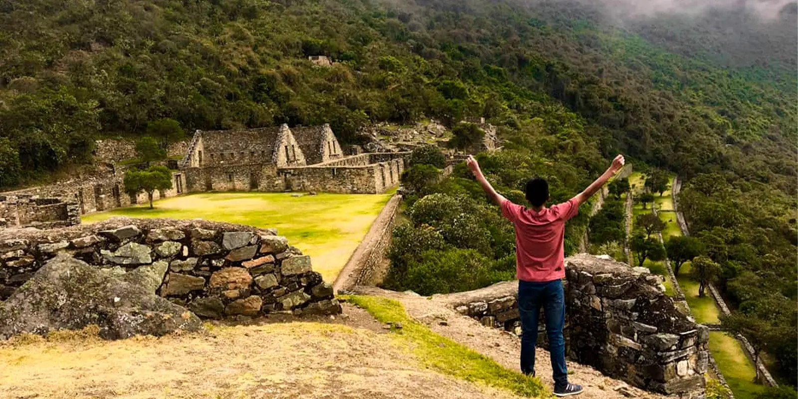
Arriving at the Choquequirao archeological site
Once in Choquequirao you have the option of seeing the citadel for the rest of the day or camping in the ruins (there is a camping spot there) and exploring the next day more peacefully.
Since Choquequirao is not 100% discovered, the citadel can be seen relatively quickly. Don’t miss the main plaza and its surroundings and the llama’s platforms. This last spot requires extra effort but is totally worth it.
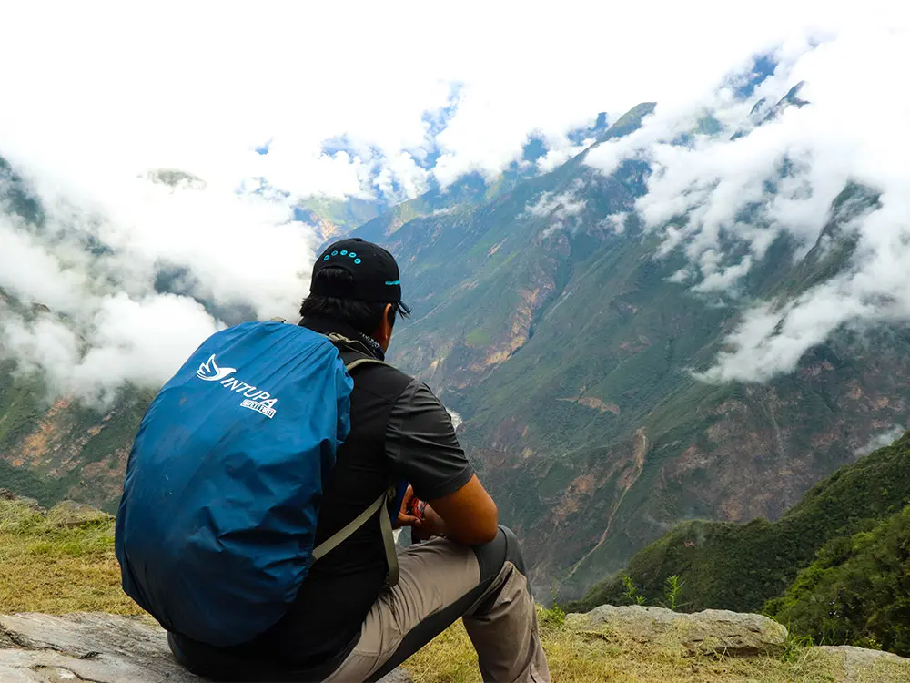
As the early morning mist lifts we set off again, high on the valley side, with stunning views over the vast Apurimac canyon, orchids, bromeliads and lichens lining the way. It’s a gentle meander to Choquequirao and our legs will be glad of the temporary respite on this rolling section of path. We take time to wander, exploring the corners of this beautiful Inca site, which we have to ourselves. You will only see a handful of trekkers along the way.
It is thought Choquequiaro was constructed during the reign of the 9th Inca emperor Pachacutec, dedicated to the sun, the water and the apus (mountain gods). The site boats long terraces, temples, a main square, ceremonial platforms, palaces, houses and water canals. The location is dramatic, spectacularly constructed over a ridge high above the Apurimac gorge, snow peaks all around. Condors soar overhead and you may be lucky and see a spectacled bear.
My top tips for what to pack for the Choquequirao trek are:
- Take long sleeved light weight shirts and trekking trousers as it can be hot, the sun is strong and there are biting flies.
- Take sunblock and good insect repellent.
- A sunhat is useful as there is little shade.
- Take at least 2 liters of capacity for water and purification tablets.
- Take walking poles.
- Comfortable walking boots and socks (I love bamboo socks in the heat) are essential as this trek is tough on the feet.
What is the actual distance from the trailhead to Choquequirao?
The actual distance from Capuliyoc (the starting point) to Choquequirao is 25km. It’s the same distance on the way back, making it a total of 50km round-trip.
How difficult is the Choquequirao trek?
Very! We recommend this beautiful and challenging trek for experienced trekkers or people in good physical shape who are used to hiking or running frequently.
This site is remote and rarely visited. There are no easy days to look forward to. In addition, you will descend to lows of 1 400m/4 593ft and then ascend to highs of over 3 100m/ 10 010ft and back down again. The altitude will not be your biggest challenge, it does not get as high as Rainbow Mountain for instance. However, you still get pretty high, so you need to acclimatize, either in Cusco or the Sacred Valley for a day or 2. The trek is very taxing on the legs. With everything said, it is 100% worth it. You will hike in total peace and explore the ruins with no tourists around. Compared to the thousands of visitors coming to Machu Picchu every day, Choquequirao only has an average of 25 visitors a day. It truly is an enjoyable experience to join this elite club of trekkers.
ITINERARY FOR THE CHOQUEQUIRAO TREK?
DAY 1: CUSCO – CAPULIYOC – CHIQUISCA – LA PLAYA
Your guide will pick you up from your hotel at 5am and you will drive for the next 4 hours in our private van to Capuliyoc (2,850m/9,407ft). Along the way, there are wonderful views of villages, valleys and snow-capped mountains. Once at Capuliyoc, we meet our horsemen and give him our duffels so he can pack all of our equipment onto the horses. From here, you will only carry your daypack.
After a picnic breakfast, we start walking to Chiquisca, overlooking the Apurimac Canyon and snow-capped mountains such as Padreyoc (5,571m/18,387ft). You will also have your first glimpse of the Choquequirao site off in the distance. We will have lunch along the trail followed by a two hour descent to our first campsite at la Playa (1,900m/6,270ft). Hot drinks and appetizers will be waiting for you. Your tents will already be set up for you, so you can settle in before dinner.
- Meals: Breakfast – Lunch – Afternoon Tea – Dinner
- Accommodation: Camping facilities
- Minimum Altitude: 1,900m/5,700ft
- Maximum Altitude: 2,850m/9,400ft
- Distance: 18kms/11 miles
- Difficulty: Difficult
DAY 2: LA PLAYA – MARANPATA – CHOQUEQUIRAO
After an nice breakfast, we descend to the beautiful Apurimac River (1,550m/5,117ft) and then hike uphill to the rural village of Maranpata (2,850m/9,350ft), where we have lunch while enjoying the amazing views of the Choquequirao archeological site (3,150m/10,397ft). As we trek, we walk through a natural garden of flora and fauna to Choquequirao, where we will have a private guided tour. During the tour, we will explore all the important sections, such as the palaces, temples, ritual water fountains, amazing Usnu (ceremonial platform), agricultural terraces, llama area and much more. Finally, we head to our campsite, located just 20 minutes from the Choquequirao ruins, where we will have tea time and dinner before settling in for the night.
- Meals: Breakfast – Lunch – Afternoon Tea – Dinner
- Accommodation: Camping facilities
- Minimum Altitude: 1,550m/5,117ft
- Maximum Altitude: 3,150m/10,397ft
- Distance: 14kms/9 miles
- Difficulty: Difficult
DAY 3: CHOQUEQUIRAO – CHIQUISCA
We will have an early breakfast and explore some more of the incredible areas of Choquequirao before heading back to the indigenous community of Maranpata for lunch. Afterwards, we descend for 3 hours back down to the magnificent Apurimac River (1,550m/5,117ft). Finally, we walk for one hour up a moderate hill to our campsite at Chiquisca (1,990m/6,270ft).
- Meals: Breakfast – Lunch – Tea Time – Dinner
- Accommodation: Camping facilities
- Minimum Altitude: 1,550m/5,117ft
- Maximum Altitude: 1,990m/6,270ft
- Distance: 14kms/9 miles
- Difficulty: Difficult
DAY 4: CHIQUISCA – CAPULIYOC – CACHORA – CUSCO
We have a lovely breakfast in the morning before we start our walk up a moderate to difficult hill towards the Capuliyoc pass. From the pass, we can appreciate the breathtaking views of the surrounding mountains and the Apurimac Canyon. Then, we walk for another 2 hours towards Cachora (2,850m/9,407ft) for lunch. After lunch, we take our private transport to the archeological site of Saywite, where we have plenty of time to explore. Finally, our driver will take us back to Cusco and drop you off at your hotel, arriving in the evening around 8pm.
- Meals: Breakfast – Lunch
- Minimum Altitude: 1,990m/6,270ft
- Maximum Altitude: 2,850m/9,407ft
- Distance: 16kms/10 miles
- Difficulty: Difficult
The itinerary has been privided by Orange Nation Peru!